Putting Marine Science on the Map
Originally appears in the Spring 2011 issue
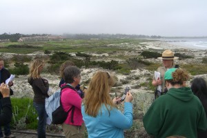
How do you put marine science on a map? Marine educators anywhere in the world can create an online map of their local beaches, tide pools, creeks and watersheds. In this article, we’re going to divulge tips and tricks for making your own online map.
Online mapping is not only a unique tool to share information about a local habitat or environment, but also lets visitors near and far interactively experience what a location has to offer. Maps can now “come to life.” Online maps can be used as a preview or guide for visitors or as a virtual tour for those not able to visit in person. The ability to add images, videos, and text to maps makes them powerful and creative learning and assessment tools for teachers and students. Because students must research, select, and organize the information and media to include in their maps, they build important critical thinking and media literacy skills. They also learn and demonstrate knowledge of marine science concepts in an engaging and memorable way.
This content is restricted to subscribers only.
If you are not yet a subscriber, please consider taking out a subscription here.
If you are an existing subscriber, kindly log in or contact us at info@greenteacher.com for more information.